One important goal of the Dark Target group is to facilitate the creation of a long term climate data record for atmospheric aerosols. The application of the Dark Target algorithm to the Visible Infrared Imaging Radiometer Suite (VIIRS) data gives the research community the potential to create this data set.
The VIIRS instrument is a 22 band operational scanning radiometer designed to continue and improve upon the AVHRR and MODIS heritage of land, ocean, cryosphere, and atmosphere measurements. VIIRS is currently flying aboard the Suomi-NPP polar orbiting satellite, and is planned to launch upon the JPSS-1 and JPSS-2 polar orbiters. With an expected instrument lifetime of seven years, and an expected JPSS-2 launch in 2023, a combined MODIS - VIIRS data set will allow the creation of a combined 30 year aerosol climate data record. Although a high quality aerosol product is available from NOAA unfortunately there are too many differences between it and the NASA MODIS product to treat them as a single climate data record. To accomplish the goal of creating a compatible MODIS-VIIRS product data set the dark target group has adapted the C6 algorithm to run operationally on VIIRS raw instrument data. This MODIS-like aerosol product (see Developing DT for VIIRS page) from VIIRS measurements uses cloud masking, land-sea masking, pixel selection, radiative transfer, inversion, and quality assurance which are all consistent with the MODIS DT C6 algorithm. The details of this adaptation will be presented on the succeeding VIIRS algorithm pages.
If you are not familiar with VIIRS and want to understand the NASA VIIRS DT product we strongly suggest that you take some time to learn about the sensor. There are several excellent sources for information about VIIRS including a beginners guide to VIIRS and the NOAA-VIIRS imagery products which can be found here. This guide was written by Curtis Seaman of CIRA/Colorado State University. Many links where you can find additional information about VIIRS can be found on the Colorado State website.
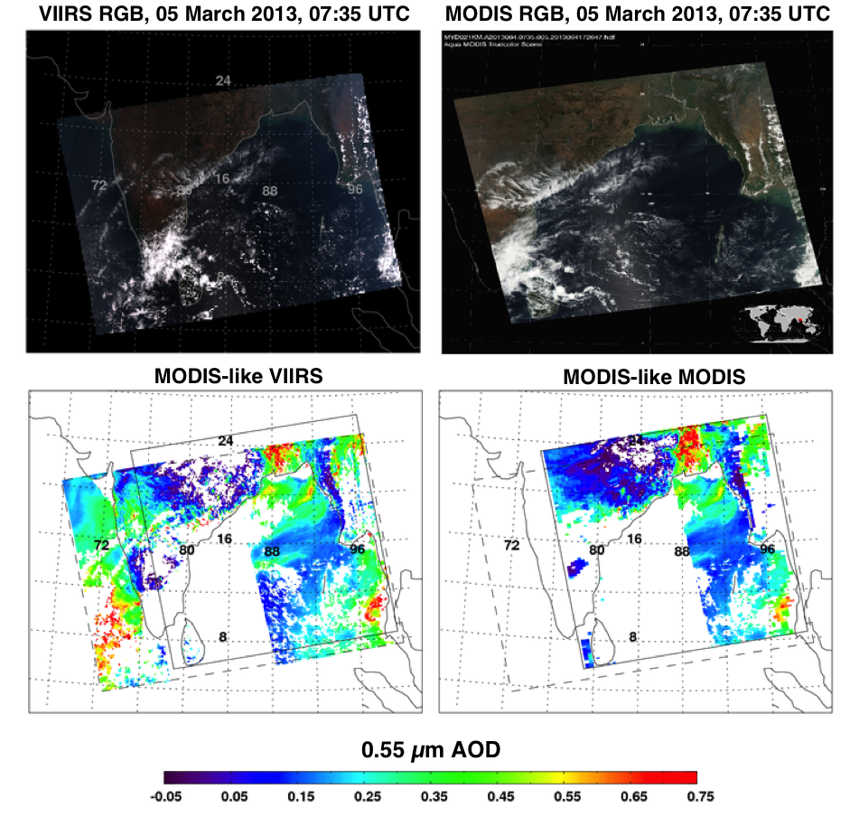
A sample image granule comparing MODIS and VIIRS observations of the same region at the same time is shown below. As you can see there are several differences which impact the instrument products. For a detailed explanation of the differences and similarities in the two sensors and how they impact the VIIRS DT Product please see the powerpoint presentation on this page.