
Validation Method Overview
MODIS dark target aerosol products for land and ocean are validated by comparing Aerosol Optical Depth (AOD) values against AOD measurements made by AERONET ground based instruments. You can find out more about AERONET here. The AERONET AOD values are considered to be "true" and the satellite values are compared against the aeronet values on a site by site basis. For the ocean prouct, validation data from the AERONET Maritime Aerosol Network (MAN) are also included however since these are mobile sites this data is only used for global or regional comparisons. Temporal and spatial matching of the satellite and ground data as well as data quality screening is employed for all points used for the validation analysis. All MODIS aerosol products are considered "validated" when 67% of the points fall within a bounding envelop of "estimated error" as compared to AERONET. The estimated error values are different for the land and ocean products and may vary with each product collection. They are also wavelength dependent. The estimated error values are listed below in the more detailed discussion of the method and also on the land, and ocean product pages.
Validation Method: Data Selection
AERONET instruments measure AOD using two different protocols. One of these derives AOD by measuring incoming radiation from the direct beam of the sun while the second protocol uses diffuse radiation measurements from various directions in the sky to derive the AOD. These measurements are made several times per hour the exact number depending on the angle of the sun. Additionally AERONET AOD data is computed for three different quality levels: Level 1 (unscreened), Level 1.5 (cloud-screened) and Level 2 (cloud-screened and quality assured). The AERONET data used for MODIS AOD validation is only from direct sun radiation measurements of Level 2 quality.
AERONET instruments collect data in multiple wavelengths many of which are slightly different from the MODIS channels. Aeronet data using their 0.44, 0.50, 0.67, and 0.87 µm channels is converted to MODIS equivalent channels using a quadratic interpolation. Comparisons are made at the MODIS 0.47, 0.55, 0.67, and 0.87 µm wavelenghts.
MODIS data comes with a quality assurance (QA) designation with values ranging from 0 to 3 where 3 is the highest quality. For Land validation only QA 3 data is used. For Ocean validation all QA above 0 is used.
Validation Method: Spatial and Temporal Data Matching
For a point to be including in the validation analyis the AERONET and MODIS measurements must be matched in space and time. For the spatial matching we draw a circle of fixed radius around the aeronet site of 27.5 km for the 10 km product and 7.5 km for the 3 km product. We require a minimum of 20% of all possible satellite retrievals of the required QA within this area to use this point in the validation data set. We average all qualifying MODIS AOD values to compare against the AERONET AOD. For the temporal matching we require at least two AERONET direct sun level 2 measurements within 30 minutes of the MODIS overpass ( a temporal window of 60 minutes). We average all qualifying AERONET measurements to compare against the MODIS AOD.
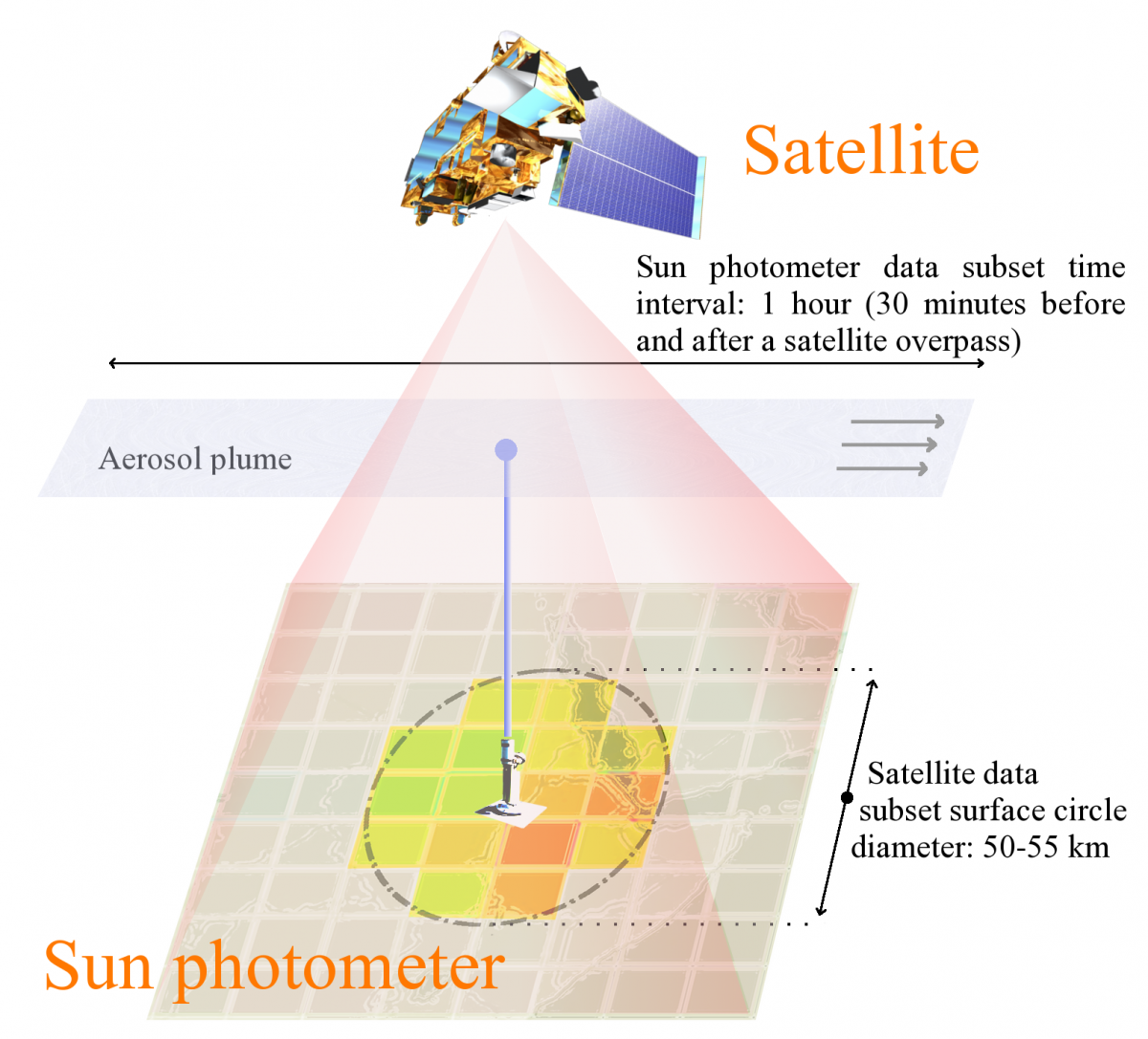
The drawing above shows the selection criteria for the spatial and temporal matching of MODIS satellite and AERONET ground measurements used in our validation studies for the 10 km product. For the 3 km product the subset surface circle diamter would be approximately 7.5 km at nadir. Image courtesey of Maksym Petrenko.