
Overview
Quantitative aerosol retrieval from space grew out of the need for atmospheric correction, that is the process of removing atmospheric effects on satellite remote sensing of earth's surface. Important satellite measures of land surface vegetation and ocean color were confused because of changing aerosol above the scene. The physical concept is that over "dark" surfaces (vegetated land and dark ocean), aerosol appears to brighten the scene, and the by-product of atmospheric correction is the retrieval of aerosol properties. As the scientific community became interested in quantifying the aerosol (e.g. for climate purposes), the dark target concept was refined. This website description is intended to be a synopsis of the retrieval algorithms as currently operational on the MODIS satellite instrument. These algorithms were originally pioneered and developed by Didier Tanre (Tanre et al., (1997)) and Yoram Kaufman (Kaufman et al., (1997)).
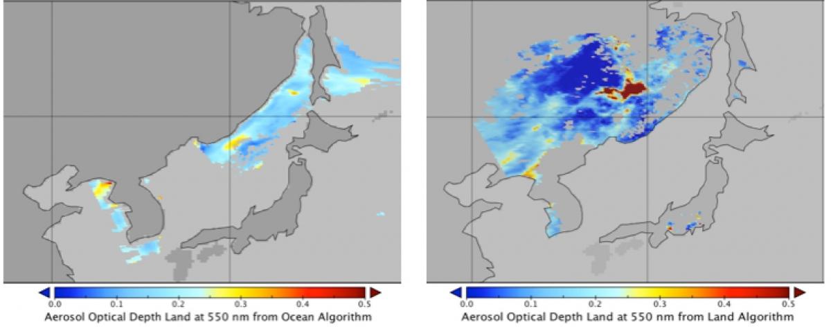
There are two separate and distinct “Dark Target” (DT) algorithms. The first one is used for retrieving aerosol information over ocean (dark in visible and longer wavelengths) and the second one over vegetated/dark-soiled land (dark in the visible).
In theory, these algorithms can be applied to any sensor that measures reflectance in appropriate wavelength bands covering visible (VIS), near-IR (NIR) and shortwave-IR (SWIR). Therefore, it is being modified to use on VIIRS observations as well.
The algorithm section of the site gives an overview of the retrieval algorithm and steps common to the land and ocean algorithm.
This website description is intended to be a synopsis of the algorithm; for more details, see the ATBD pages of this website or refer to the MOD04 ATBD, Levy et al. 2013 and Remer et al., 2013
As applied to MODIS, the standard dark Target aerosol product is 10 x 10 km at nadir that expands roughly four-fold towards the edges of the swath.
![]()
This aerosol product is labeled Level 2. For Collection 6, a new product is available which has a 3 x 3 km resolution at nadir. Although minor adjustments are made to accommodate the smaller pixel size, the fundamentals of the algorithm remain the same. The land and ocean algorithm subsections will describe the algorithms for the 10 km product, and the 3 km section will describe the necessary modifications.