The MODerate resolution Imaging Spectrometer (MODIS) instrument flies on the Earth Observation System’s (EOS) Terra and Aqua satellites. Both satellites are polar-orbiting, with Terra on a descending orbit (southward) over the equator about 10:30 local sun time, and Aqua on an ascending orbit (northward) over the equator about 13:30 local sun time. From a vantage about 700 km above the surface and a ±55° view scan, each MODIS instrument views the earth with a swath about 2330 km, thereby observing nearly the entire globe on a daily basis, and repeat orbits every 16 days. MODIS performs measurements in the solar to thermal infrared spectrum region from 0.41 to 14.235 μm (Salomonson et al., 1989). Detailed specifications and components can be found at http://modis.gsfc.nasa.gov. More detailed information of the MODIS aerosol product, including updates for the latest Collection 6 release can be found at http://modis-atmos.gsfc.nasa.gov/.
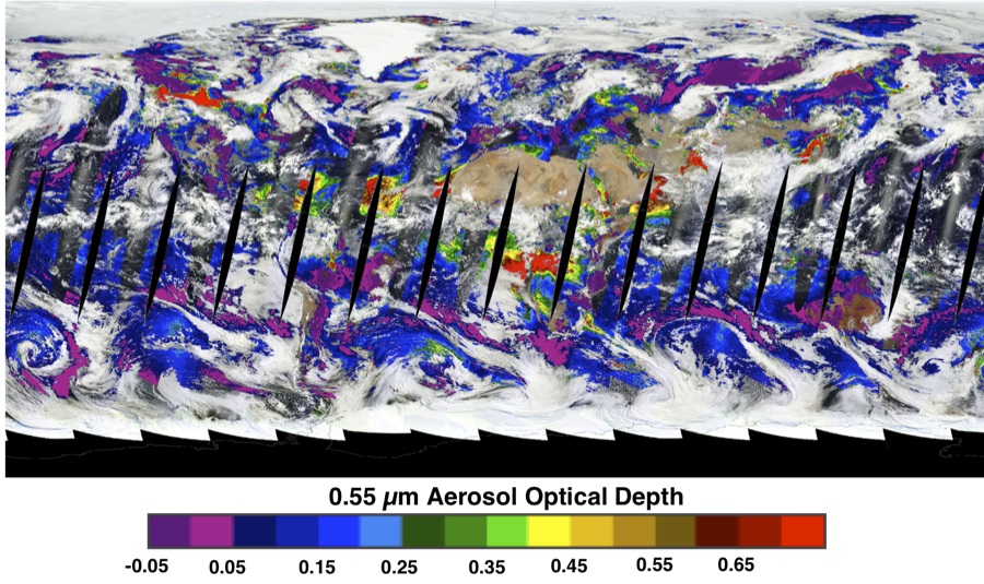
An example of a full day of MODIS aerosol optical depth, overlaid on top of the MODIS RGB, is shown below. This day is August 15th 2014 as viewed by the Terra satellite.