
The Himawari Satellite and Advanced Himawari Imager
The Himawari series of satellites are operated by the Japan Meteorological Agency (JMA). Himawari means “sunflower in Japanese. They are mainly weather satellites operating in geostationary orbits dating back to Himawari 1 (or GMS-1) which was launched in 1977. Himawari 8 & 9 (H08 and H09) are most recent satellites in the series and observe from near 140°.7 East longitude. Each of these platforms carries an almost identical version of the Advanced Himawari Imager (AHI) onboard. AHI on H08 and H09 are very advanced sensors in term of imaging technology having a wide spectral range with very high spatial and temporal resolutions. H08 was the operational satellite until 13 Dec 2022, with H09 becoming operational since then.
AHI make measurements of top-of-atmosphere radiances in 16 spectral bands ranging from 0.47 to 13.31 μm. The spatial resolution varies from 0.5 to 2 km depending on the band. The AHI instruments scan over six different regions with varying temporal resolution. A full disk image (as shown below in Figure 1) is available every 10 minutes whereas other regions can be observed as frequently as 2.5 minutes to 30 seconds. The very high temporal and spatial resolution observations of earth-atmosphere system from the AHIs can be very useful not only in weather monitoring but measuring other atmospheric components such as aerosols and clouds.
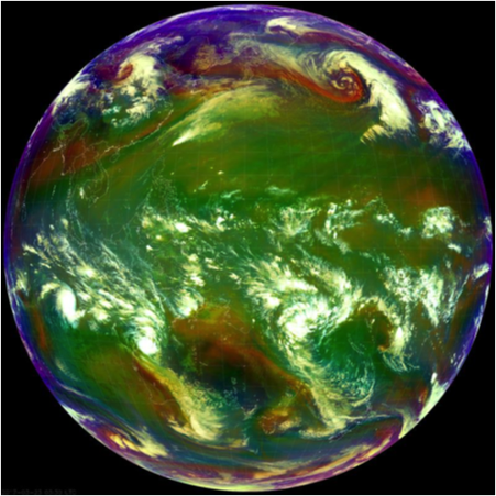
Figure 1. Full disk image taken on March 23, 2017 at 03:30 GMT from AHI onboard the Himawari 8 satellite.
The MODIS dark target algorithms for both land and ocean have been modified to make use of the AHI spectral bands in order to retrieve a MODIS-like aerosol product. This was first accomplished using AHI observations obtained during the KORUS-AQ field campaign held in Korea from May – June of 2016. In order to account for MODIS-AHI differences in the spectral channels, surface characterization over land has been also modified in the AHI algorithm. The following images show some aerosol retrieval examples from Himawari 8 sensors.
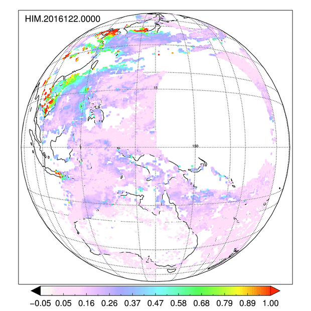
Figure 2. Animation of aerosol optical depth retrieved from AHI onboard Himawari 8 from May 1-15, 2016. Full disc view.
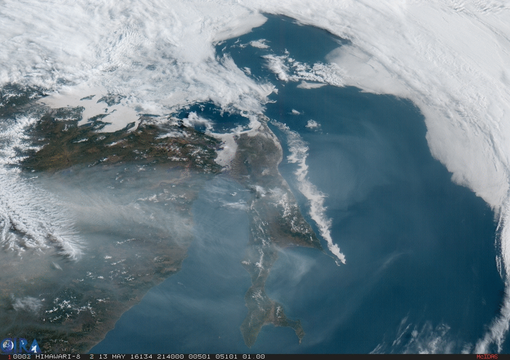
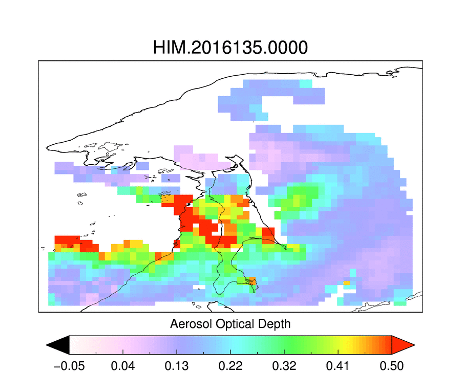
Figure 3. Smoke transport on May 14 and associated aerosol retrieval zoomed over Japan Sea.
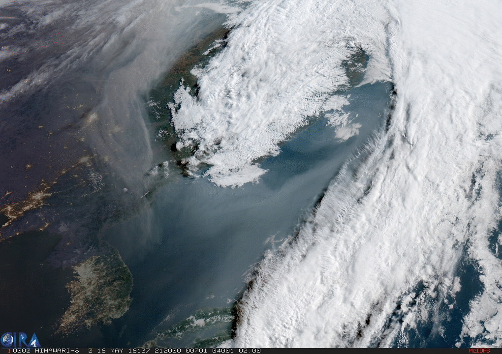
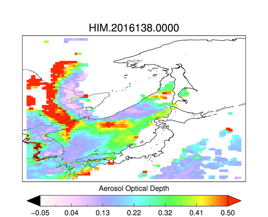
Figure 4. Smoke transport on May 17 and associated aerosol retrieval zoomed over Japan Sea.